Brought to you by Howard Sheckter
Friday’s Storm Highlights……Warming Up Next Week…..
Saturday May 26, 2012
Chilly….that is what it was Friday…Breezy too! Snowfall?? Well the Dweebs did see plenty of showers but only a dusting accumulated….so a bit of a disappointment in that department. When ever you have a dry front followed by an upper low that brings the main shot of precip by upper divergence you can get disappointed. Kinda like what Forest says….It’s kinda like a box of chocolates, you never know what your gonna get for sure….
Here are some interesting points of this storm locally;
Mammoth RAWS sites:
Old Mammoth: At elevation 8012feet, the high temperature was 31 at 9:30am yesterday and the 24Hr low actually occurred during a convective snow-shower at 3:30pm and was 23 degrees! The overnight low of 24F actually occurred at 3:30am and by Sunrise or just after when the usual diurnel low occurs, was already 27 degrees…with little change in wind speed. So air mass modification was already occurring as the 500mb-1000mb 546dm thickness pool aloft was shrinking and moving ESE while the surface low located along the NV/Utah border was racing east toward Colorado.
Saturday mornings circulation of being on the back side of the 500mb and 700mb upper low is Northwesterly. There is still some 700mb RH that will come through the first half of the day and plenty of unstable air aloft for some showers and possible thunder. By tonight, the air mass stabilizes with subsidence setting in. Sunday will be notable warmer with some clouds especially in the morning. Temps will rise well into the 50s then 60s Monday.
After more then 24 hours of below freezing temps in Mammoth, temps are rising above freezing this morning…the worst is over as far as the cold…..
Although tonight’s temps will go below freezing again….it will be of shorter duration and a lot of the cold will be sink to the lower elevations Sunday AM as subsidence develops late tonight into Sunday.
Longe range:
For the most part 500mb heights will rise Monday through Thursday of next week with the 500mb 582DM height line not lifting north of Mammoth Lakes until Wednesday PM. So quite a bit of warming is expected to set in between Wednesday and Thursday for the upcoming week. Additionally, there is a weak trof that comes into the west coast that causes a sheer lobe vort center to form off the Southern Ca coast. With the combination of 500mb heights above 582dm and some weak divergence over the southern sierra Wednesday there looks to be some afternoon clouds Wednesday and Thursday. Longer range shows weak divergence aloft and an area of deformation (surface convergence) over the central/southern Sierra for a slight chance of TSRWS on Friday. It may be a bit cooler next weekend…..
Longer Range:
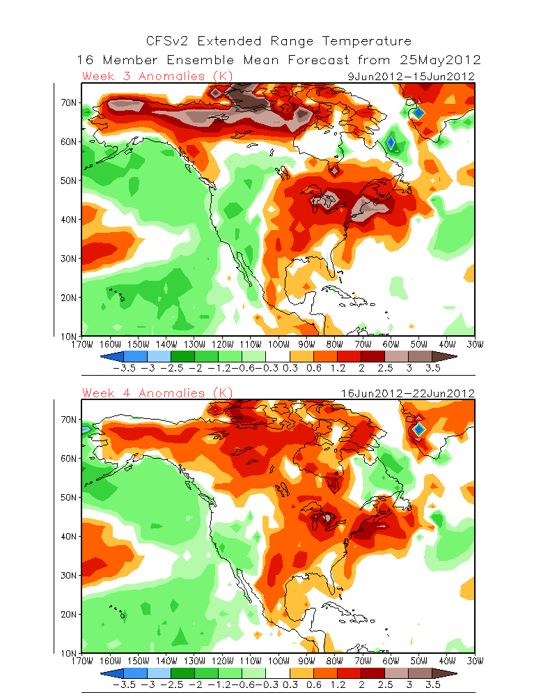
The climate Forecast Center is forecasting a bias toward cooler then normal temperatures here in the Eastern Sierra through the end of Spring with normal precepitation. See: http://www.cpc.ncep.noaa.gov/products/people/sweaver/cfs_fcst/images1/wk3.wk4_20120525.NAsfcT.gif
Dweebs Comment:
Although we will have some nice warm weather later this week with highs in the 70s……
The Negitive Phase PDO continues…..Heights aloft will probably remain above normal over the warm water pool located NW of Hawaii, between Hawaii and the Dateline. Cooler then normal SSTAs will continue off the west coast for cooler then normal temperaturesr more often than not, along the immediate central coast this Spring into Summer. It appears that there will be a bias for normal to below normal temps here in the high country through Spring. So expect expect more freezes between now and fathers day…and some periods for some nice warm weather as well!!
Dr Howard and the Dweebs…………………….:-)
————————————————-
Reference Glossary of Weather Terms
Disclaimer: I have been a hobbyist meteorologist for over 30 years here in the Mammoth area and I do this for my personal enjoyment. The National Weather Service saves lives every day . . . I do not. When making important planning decisions please use information provided by the National Weather Service as they are the most knowledgeable and accurate information source available today.


