Brought to you by Howard Sheckter
Warm…Breezy…Dry Weather to Continue Through Weeks end, with the Coolest Day Saturday……Some Old Hurricane Debris May End Up Over Central Ca About the 4th…..
Tuesday August 28, 2012
Latest guidance through the last few days of August shows the weather in Mammoth ending on a warmer then normal note. Highs at 8000ft should continue in the mid 70s. It will be exceptionally dry and quite breezy as well. The 12z GFS has heights at or above 588DM through 12z Wednesday then lowering a bit south of 582Dm by Saturday with the possibility of a dry cool front coming through during the day. So Saturday will be a breezy one with high cloudiness and possibly some Alto Cu as well. The High temps may cool to near or slightly below 70 at the village. Overall, a nice late Summer weekend with near seasonal temps, except Saturday. Lows Sunday Am in the 30s.
This is the time of year the climatically we could get some dying Tropical storm moisture coming up from the south or SSW. There are currently TS’s over the eastern tropical pacific. One the will move NW off the Baja coast later this week. Some times we can get showers from these if conditions are right.
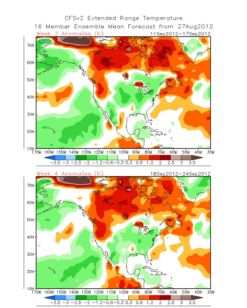
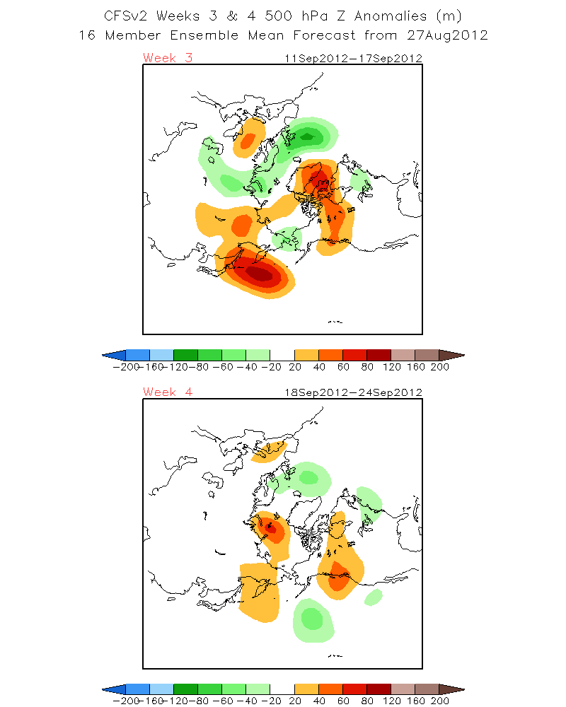
Looking at the EURO for the next 10 days. The trend for above normal temps is certainly there through the end of the 1st week of September. So locals enjoy!!! To bad that most of the festivities will be over after Labor Day. If you believe in the CFS 2 experimental charts, somewhat above normal temps will continue more often then not….right on through a good part of September!! That means that high temps will be mostly in the low 70s for the month of September.
See: TEMPS http://www.cpc.ncep.noaa.gov/products/people/sweaver/cfs_fcst/images1/wk3.wk4_20120827.NAsfcT.gif
500MB Anomalies http://www.cpc.ncep.noaa.gov/products/people/sweaver/cfs_fcst/images1/wk3.wk4_20120827.z500.gif
By popular demand……My 1st best guess
Some very early thoughts about the upcoming winter:
1. CFS 2 model continues to back peddle on the strength of EL Nino indicating that by Winter it may actually end up either a weak El Nino or a La Nada Winter.
See: Latest CFS #2 : http://origin.cpc.ncep.noaa.gov/products/people/wwang/cfsv2fcst/imagesInd3/nino34Mon.gif
Check out Precip Anomalies: http://origin.cpc.ncep.noaa.gov/products/people/wwang/cfsv2fcst/imagesInd3/nino34Mon.gif
Model says Feb, March and April best precip months? Keep In mind that this is an experimental model.
2. What about the MJO? That is the maverick that could make all the difference this Winter as it has an notably stronger effect odds wise, during Weak El Ninos…La Nada’s and Weak La Nina’s, which this winter will most likely be. IE. there may be relatively short periods of intense precipitation over the Sierra this mid to late Winter.
3. The QBO is currently in its Easterly Phase for about the last 12 months, typically weakening the build up of cold air over the Eastern half of Canada last winter. That will change with the oscillation flipping back to westerly by years end or next winter. (More favorable for blocking pattern with import of Arctic Air 1st over the west by late Fall, then via the Great Lakes about January.
4. The PDO remains negative…in the cold phase.
5. And because of all the warm SSTA’s around Greenland the NAO will be more likely negative leading to more blocking and meridional flow (IE North-South near or around the Davis Straights. That is contrary to last winter. So it will tend to be a colder winter east of the divide.
6. There is A LOT! of warm water piling up in the NW pacific with the warm pool north of Hawaii appearing to redevelop further west. This will re-inforce the -PDO with time I believe. So the -SSTA’s over the Eastern Pacific may actually grow stronger again later this year.
The Dweebs at this point are not particularly enthused about an El Nino winter for Ca. The Split Flow pattern with the enhanced Subtropical jet normally associated with El Nino may be quite incipient and Maladroit in behavior.
My gut feeling is that at this point, the winter looks wetter then last, over all; near or a bit below average precip which is usually a good winter for the Sierra, depending upon how early the storms hit.
Will Update in October or sooner if warranted.
PS… Whether a weatherman is right or wrong with a long range forecast…becasue of so many variables, any person can be right, for all the wrong reasons…….
The Dweeber…………………….:-)
————————————————-
Reference Glossary of Weather Terms
Disclaimer: I have been a hobbyist meteorologist for over 30 years here in the Mammoth area and I do this for my personal enjoyment. The National Weather Service saves lives every day . . . I do not. When making important planning decisions please use information provided by the National Weather Service as they are the most knowledgeable and accurate information source available today.


