Brought to you by Howard Sheckter
Chilly beginning of this week to be followed by Moderating Temps Wednesday with system to the north Thursday then Party Cloudy but Dry Weekend…..Increasing snow pack with Wet Base Building Storms to begin possibly Middle of Next Week….
Monday November 4, 2013
The Dweebs will continue this discussion later this morning…. A series of major storms look likely to hit the northern California Coast first next week with the storm track shifting south as the week progresses. A negative tilt upper high will set up east of the dateline and north next week with a full latitude long wave trof down stream over the eastern pacific. The upper long wave trof will become both deeper and dig further south with time, tapping potentially high amounts of subtropical moisture for the west coast. There will be wet storms with heavy wet base building snowfalls for the upper elevations, eventually for Mono County as well…..
The Dweebs want to stress that this is very early in the game of pinning down any particulars. The best point one can make is that there will be a pattern change highlighted by an important positive height anomaly set up between Hawaii and the Dateline with a lot of amplification that will dig a significant long wave trof over the eastern pacific. Once the upper long wave is carved out, the upper jet associated with short waves will take aim on the central west coast.
Because of the depth and tilt of the long wave there is the potential for significant subtropical moisture becoming entrained in the pattern associated with the eastern flank of the upper trof. The actual track of the systems will determine what areas of California will get the brunt of the precipitation. At the moment, Northern California is favored through 360 hours by the ECMWF as it paints a bull’s eye just to the East of Chico, Ca of 6.4 inches accumulated over the 360 hour period. This also suggests that snow levels will be on the high side down here in the southern portion of the Central Sierra. Again this is subject to change dependent upon where the 500mb heights end up in our area.
At the moment, between 2.5 and 3 inches is being forecasted for the same time period for the Mammoth Crest. That could be 20 to 30 inches of snow up on the crest. This will change daily…as every model run is different. So this is just a snap shot from last nights Run of the EC.
In the meantime it will be a dry week….Cold today, chilly Tuesday and milder Wednesday through Saturday. Early morning Temps will be in the teens tomorrow, then moderating back to the 20s by mid week. Little change in temps there after through Saturday. Wednesday night into Thursday will be breezy. Sunday partly cloudy and dry.
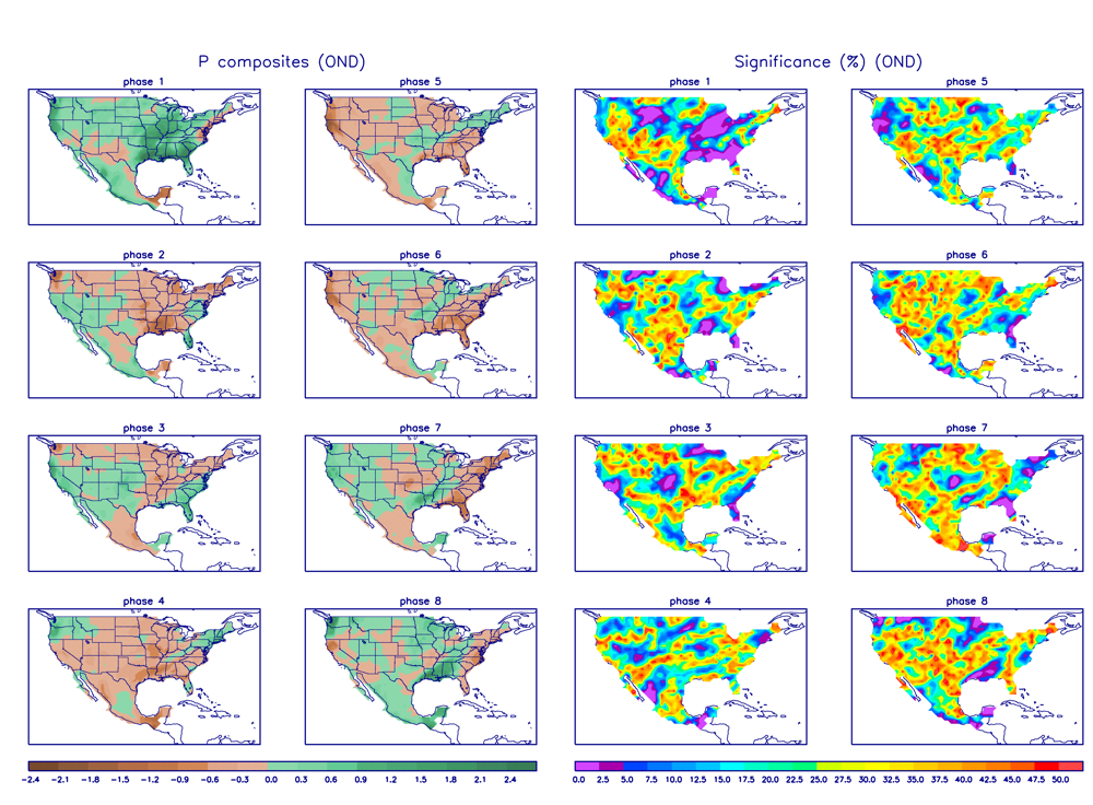
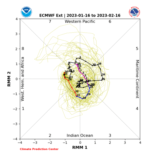
Interseasonal: MJO- location of tropical forcing… Phase 3 is highly favored for precipitation in central and Southern Ca for November.
The EMON (Seasonal Prediction Ensemble Forecast System) Looks Interesting……
http://www.cpc.ncep.noaa.gov/products/precip/CWlink/MJO/CLIVAR/EMON_phase_51m_full.gif
I like the fact that it goes along with the Dynamic Statistical Model:
http://cawcr.gov.au/staff/mwheeler/maproom/RMM/fcsts/pd.MW05.Last.gif
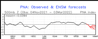
Teleconnections; The PNA teleconnection is forecasted to take a dive through the 15th of Nov. (good news)
http://www.cpc.ncep.noaa.gov/products/precip/CWlink/pna/pna.fcst.gif
More later……..
The Dweeber….


