Brought to you by Howard Sheckter
Mammoth Mt Reports 2 inches at the Main Lodge…..It is Gusty and Blustery Monday AM……Rising Heights the Next Few Days spells a warm up ahead……
Monday March 23, 2015
Although Mammoth Mt reported new snowfall of only 2 inches this morning at the main lodge…..there was .44 inches tallied in the water bucket…..Temperatures over the crest were in the lows 20s when the moisture band came through. So it is possible based upon .44 inches, there may have been 4 or 5 inches over the crest this morning based upon temperatures at the summit and snow to water ratios….
It was great to see snowfall this morning even through it was short lived!
As mentioned earlier.. Rising heights will allow for a warming trend beginning Tuesday then continuing through Friday. In that stronger ridging develops Wednesday….high temperatures will go from the upper 40s today to the low 50s Tuesday then upper 50s Wednesday. Further warming Thursday into Friday will push highs into the mid 60s. Over night lows will be in the 20s early this week with mild inversions at night setting up 2nd half of this week. Expect temps in the 20s and 30s second half of this week with warmer early morning temps above 8,000 as compared to the lower elevations of town.
Extended Outlook:
A weak Cutoff Low is expected by the end of the week on a track toward Southern CA Sunday. This is likely to cause some destabilization of the our local air mass, especially over the higher elevated heat sources. There is also the possibly of a zone of deformation to set up over the Sierra. The Forecast at this time indicated that there is only a slight chance of any shower activity next Sunday, about a week away but stay tuned.. The Dweebs may have to add some Thunder later in the week for Sunday PM.
Inter Seasonal Outlook
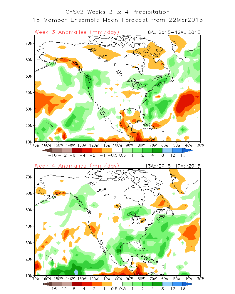
Week 3 still shows the possibly of a pattern change to the wetter. That may just mean a storm or two….. This would be likely around or just after Easter Sunday.
SEE: http://www.cpc.ncep.noaa.gov/products/people/sweaver/cfs_fcst/images1/wk3.wk4_20150322.NA.gif
Also the MJO and Dynamic Models; ECMWF Ensemble’s: http://www.cpc.noaa.gov/products/precip/CWlink/MJO/CLIVAR/ecmf.shtml
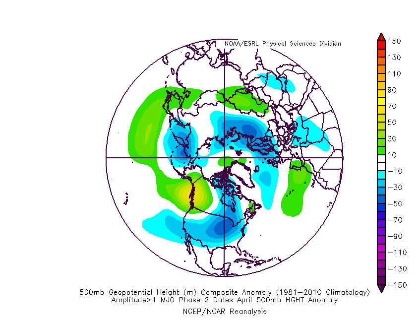
Also Composite for April Phase 2, 500MB with ENSO 3.4 of at least .5C: http://www.americanwx.com/raleighwx/MJO/MJO/AprilPhase2gt1500mb.gif
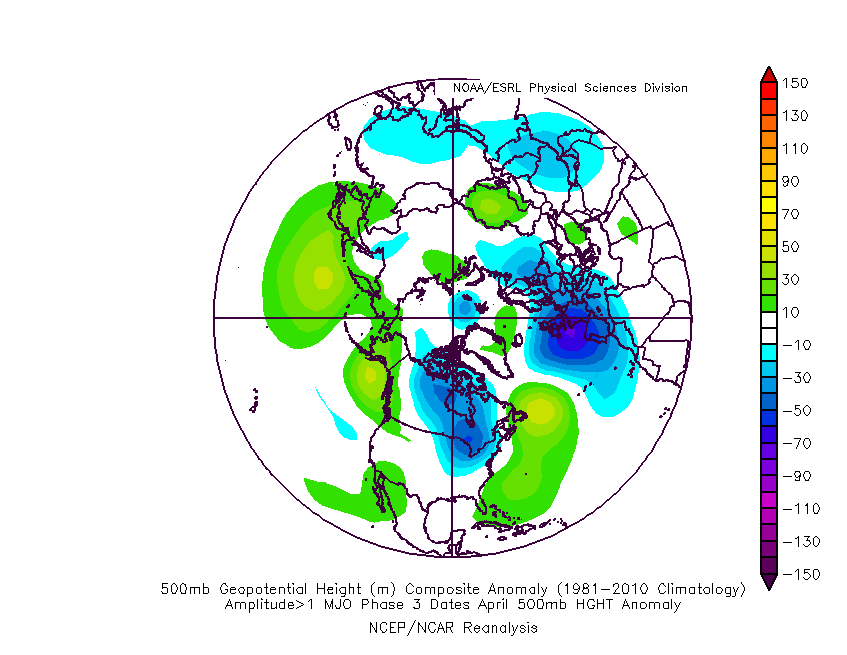
Same April Phase 3 http://www.americanwx.com/raleighwx/MJO/MJO/AprilPhase3gt1500mb.gif


