Brought to you by Howard Sheckter
A Subtropical Upper jet to bring mainly light precipitation to the high country Wednesday…..Then a rather dirty ridge is expected to develop Friday and into the weekend allowing considerable high clouds and very mild temperatures……A remarkably strong MJO is developing over the Western Pacific the next week and is expected to propagate eastward toward Central Pacific….
Tuesday March 10, 2015
Wednesday AM:
Light snow is currently falling in the Town of Mammoth. Snowfall amounts are expected to be in the inch or two range on the mountain with a trace expected in Town, mainly above 8K.
As far as the short and medium range forecast’s. All of the guidance indicates, drier than normal and warmer than normal conditions prevailing, beginning Thursday and continuing through early next week. Highs this weekend will be in the low 60s while considerable high level cloudiness is expected at times. (Dirty Ridge)
Longer Range:
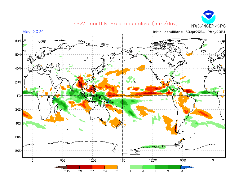
According to the CPC, there is not much support in the dynamical models for significant tropical moisture transport into California during the Weeks 2-4 time period. (Mid March to Early/Mid April) The CFS does indicate “some potential” for modest California wetness during Weeks 3 and 4, but the ECMWF maintains a dry signal. Most of the tropical moisture is anticipated to remain over the northeastern Pacific; see: http://www.cpc.ncep.noaa.gov/products/people/wwang/cfsv2fcst/imagesInd3/glbPrecMonInd1.gif for the latest CFS March outlook.
Additionally, the model guidance supports above normal temperatures persisting through the end of March for California, which would not be supportive of any late season mountain snowfall, and would promote early melting of the little snowpack that exists.
Of note; the PDO came in at positive record levels again for the month of February. These are 115 year records dating back to 1900. With another robust Down welling event translating eastward across the Central and Eastern Pac, no doubt that the +PDO signal will not flip negative, anytime soon…
The Dweeber…………………………….:-)
________________________________________________________________________________________________________________________________________________________________________________
Lots going on with the Madden Julian Oscillation and potential future weather changes more on an inter-seasonal time scale or even climate time scale than anything else this morning. The Dweebs have been watching the forecast of a robust MJO that is forecasted to flare over the western pacific the next 10 days. The forecasts in the some of the global models has been showing the standard deviation from normal, off the chart in phase 7 and progressive in many cases into phase space 8. The Dweebs have been poo-pooing any serious effects for the CONUS from this tropical forcing, mainly because the statistical model has not shown any sync with this anomaly. The Dweebs looked at the statistical model this morning and its taken off. So we got a real event that is going to have significant effects upon the CONUS in a couple of weeks, and possibly on a climate time scale I suspect. The MJOs lead time is often beyond week 2, so chances are, it has not been reflected in the global models yet! I will be attending a special webinar from the CPC this afternoon and will report tomorrow AM on the same.
Although unrelated, another robust Kelvin Wave is translating east with some of the core heat in the wave, sub-surface as high as +6C! This appears to be another strong Kelvin Wave translating east, that will hit the Central American coast later this Spring and push anomalous warm water north along the Mexican coast, and eventually the west coast of the CONUS, including CA this Summer reinforcing the +PDO. It is interesting to note that Kelvin Waves can jack start Warm ENSO events. Additionally, Strong MJO’s can also Jack start Warm ENSO events. So there is something interesting going on and I suspect that it should be a very interesting day today at the CPC…..
The Dweeber………………………:-)


