Brought to you by Howard Sheckter
Cool Breezy weather for Monday with warmer weather mid week…..Global models trending drier for next weekend system….with cold showery weather more likely…..
Sunday September 22, 2019
9/24/2019:
Forecasting week two periods
Forecasting week 2 periods can be tricky as we all know. We can all use the ensemble members as well as the various global models plus an extra tool called the MJO.
When the Global models are all in agreement that a cold trof will deepen down the west coast, a lot will depend upon how west the long wave is for precip odds, as well as where and how the upper jet set up.. In the case of the last 7 days, three of the four global models showed the upper low remaining off the west coast, far enough for a good SW fetch and precip several sigma’s of normal. As of this time, we have learned that a east ward shift in the long wave is going to result in a trof that will be plenty cold, but much dryer than what was earlier thought. To give credit due, the american GFS was more correct all along….with a more easterly set up.
Lets see how the MJO fared in the upcoming change for this weekend.
a. The MJO has stalled in phase one.
2. Lets see by the composites what we can expect temperatures for this this time of the year
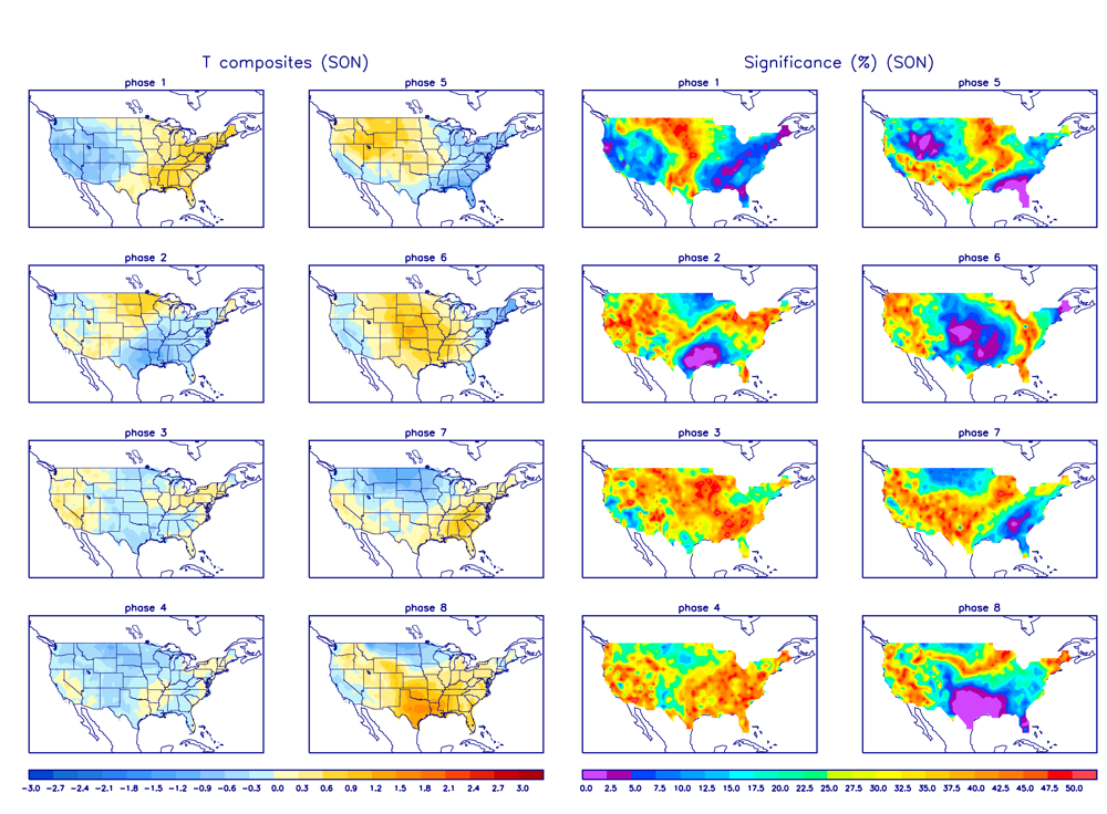
As you can see the composites are really forecasting this change to much colder weather quite well for this weekend.
3. Now lets see what the MJO show for precipitation; (phase 1)
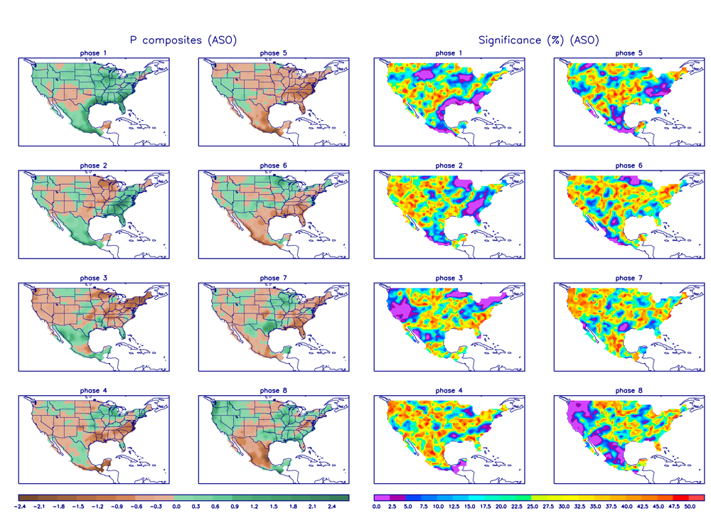
Once again there is a weak signal for precipitation as well for this time of the year with the MJO in phase one.
If the current guidance is correct for the weekend, we will have a cold weekend with well below normal temps and light precipitation according to the latest guidance.
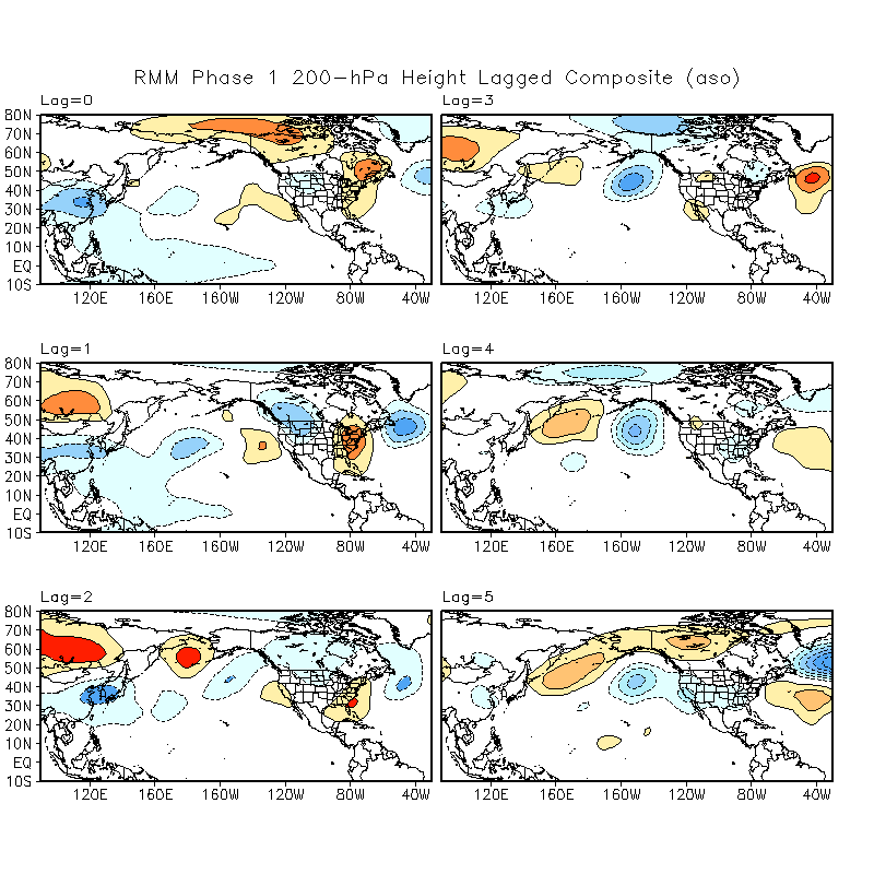
Now here are the 200hpa lagged composites… Not much help as you can see… actually October might have been a better match.
________________________________________________________________________________________________________________________________________________________________________________________________________________________
Monday AM 12-23-2019
At least the MJO forecast is correct in showing a cold 6 to 10 day period with a weak precip signal for CA. for Phase 1 in September.
Welcome to the first day of Fall…..
12Z GFS came in drier again this morning……And now the ECMWF is following suite with a cold cold weekend and snow showers. Don’t expect a lot of snow…But some 2 to 4 inches is certainly possible in the upper elevations over the weekend.
The trend suggests a cold showery weekend into early next week.
Dr Howard and the Dweebs………………….:-)
_____________________________________________________________________________________________________________________________________________________________________________________
The forecast remains unchanged for the next 5 days…..However, global models have been trending more toward the GFS earlier solution with the upper trof setting up further east. The results of the trend would be more of a cold showery pattern for Mammoth next weekend and light amounts of snowfall Friday and Saturday the end of next week…..(1 to 6 inches).
Stay tuned….


