Brought to you by Howard Sheckter
Dirty Ridge Continues to allow weak systems to bring considerable high clouds, breezes and mild temps to resort levels…..Longer Range Model trends keep the AR possibilities for next week…..Latest modeling suggest trend to wet January
Wednesday December 21, 2022
It will be a fine morning for the last few hours of Fall. Winter Solstice occurs at 1:48pm. Expect Sunny Sky’s today Wednesday with highs in the 40s with gusty winds this AM over the crest and some early day breezes in town as well. Tomorrow Thursday shows increasing high clouds. Breezy again with highs in the 40s. There will be a slight chance of some light snow Thursday night. Then dry through Monday including the Christmas holiday with highs pushing into the mid 50s and lows in the upper 20 to low 30s Sunday and Monday.
Extended Outlook:
Thoughts about next week.
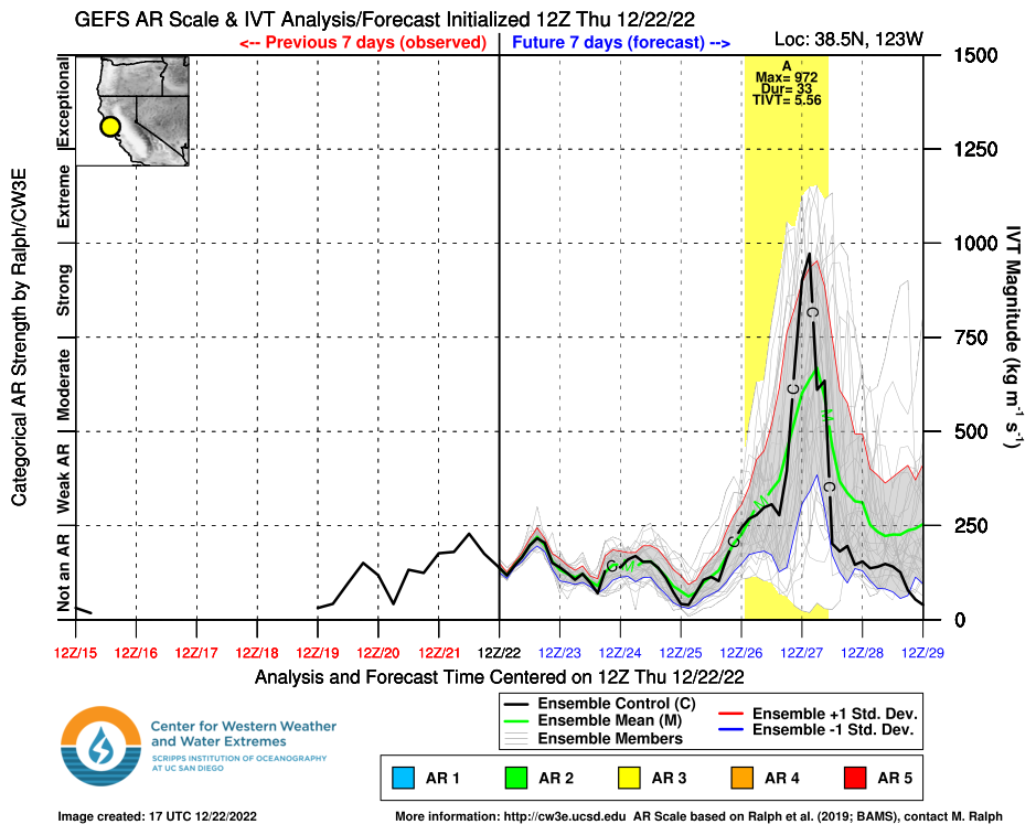
As of Thursday morning, a strong Level 3/4 event is being forecasted along the central coast and inland with borderline level 4 for coastal SFO. The peak of the AR is about Midnight Tuesday night. Snow levels will be coming down during the day Wednesday. Quantitated Precipitation” 7 day outlook is for 4 to 7 inches of water over the upper elevations, Tuesday into Thursday.
Antecedent conditions are very favorable for a heavy Rain/Snow event.
1 Portions of our Snowpack is currently partially dry snow, so it will have the ability to absorb a lot of any rain that may fall.
2. Creeks are very low due to the ongoing drought.
3. Reservoirs state wide, are very low and can handle a level 3 AR+ with no issue. However, there is always the possibility of some local street flooding.
4. The *IVT ramps up Tuesday afternoon and peaks out Tuesday midnight. Expect high winds Tuesday and into the night.
5. Local Aviation on Tuesday will have issues due to strong winds and turbulence. If they are flying and your with them, be sure to have your barf bag handy. 🙂
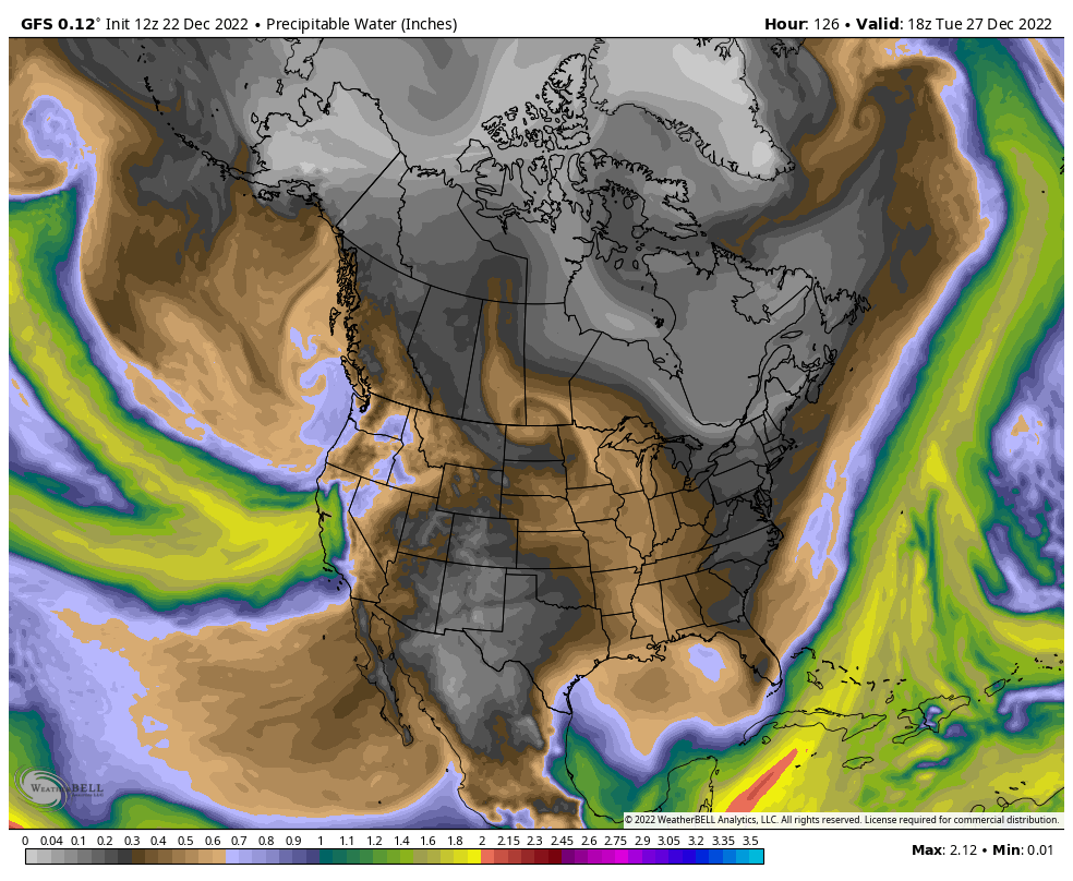
Integrated Water Vapor Transport (IVT)
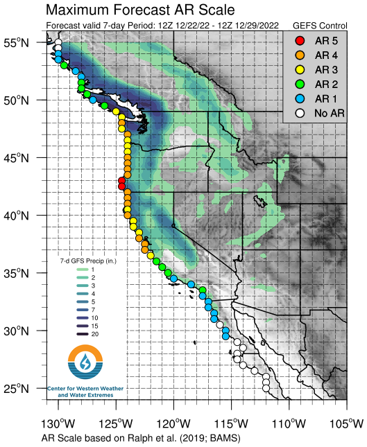
Interesting to note that the AR on the central coast is being fed by not one, but two streams… Old WX man saying….Don’t fool with an AR whom has forked transport


