Brought to you by Howard Sheckter
Major Winter Snow Storm in Play…Break on Sunday with another Sunday Night into Tuesday Night…..Pattern Change is expected next weekend…..
Friday February 24, 2023
2/26/23
Great News this AM….The Road is open to LA and most of All….The Sun is/was out! Snow forecasts were right on with 4 to 4.5 feet on Mammoth Mt storm total. Temperatures were warming up today with highs approaching freezing. That’s a big difference compared to the past week!!
The next and may I add windy systems are moving in…Wind’s are increasing and Blizzard conditions will develop by this afternoon. Road closures are possible again, so if you have to be back to work Monday…Best to make haste and head south!.
2/27/23 7:30am update
The Next weather system will offer 3 short waves….So the long wave reloads….There are three impulses within the storms. Snowfalls of up to another 3 to 4 feet are expected in town and some 4 to 6 feet on Old Woolly by Wednesday afternoon.
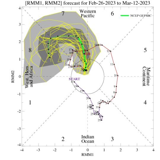
What appear to be the last of the cold storms will move toward Mammoth later next weekend…..I say that as there is a strong Madden Julian Oscillation now forecasted by all Global Models. Below is an update graphic of its intensity in the RMM Phase Space. It is impressive!
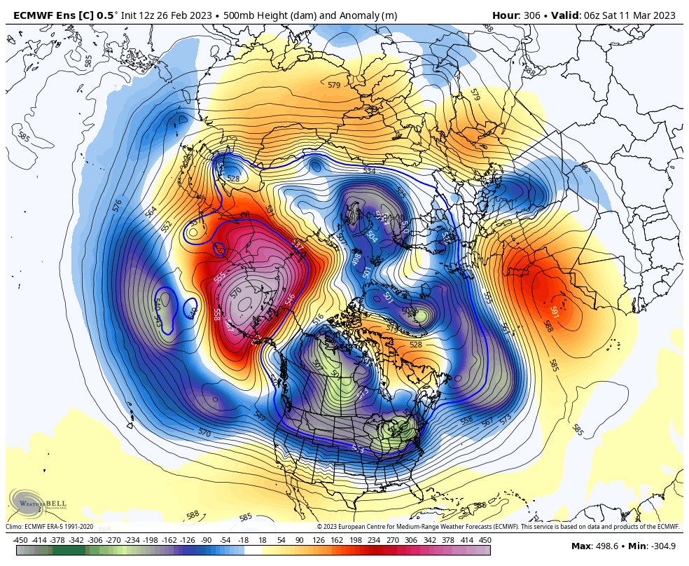
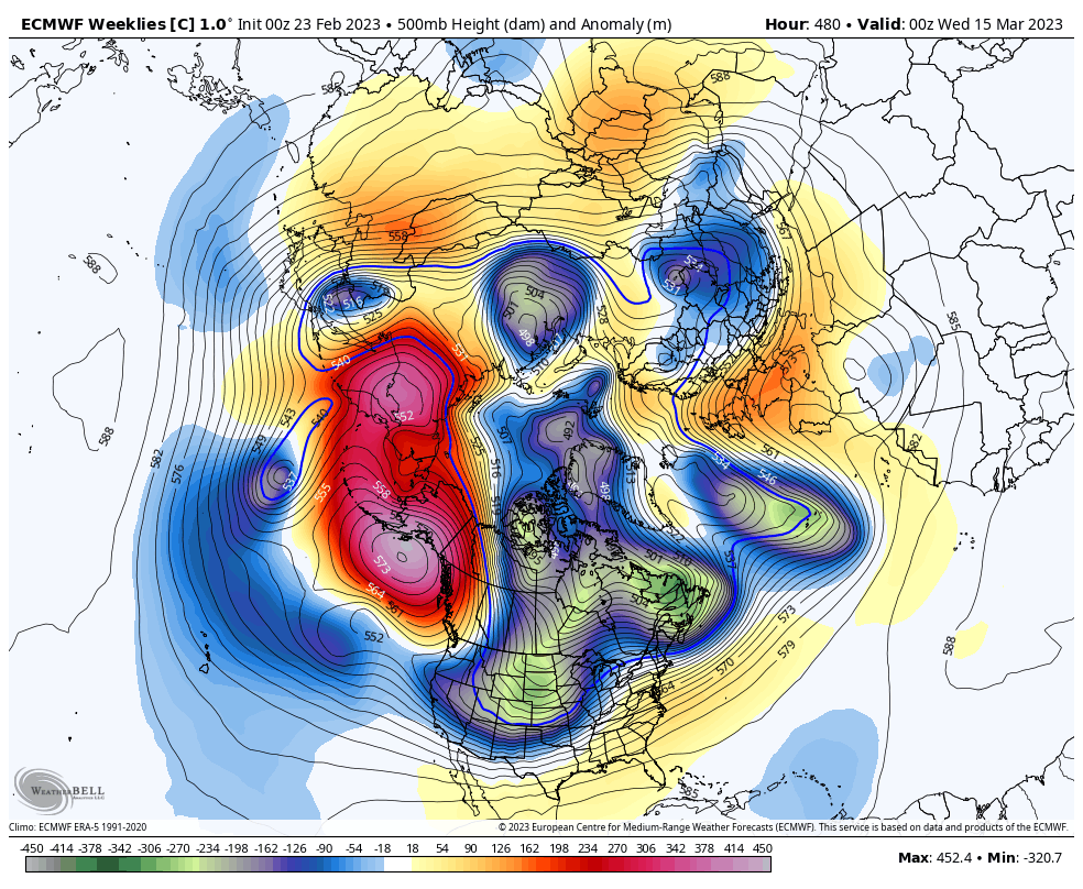
As mentioned below, this Air Sea Coupled Phenomenon will likely modulate the westerlies toward Mid Month. The effect of this change is not completely known at this time. The pattern is likely to be associated with a closed Anti-Cyclone/Negative Phase EPO/WPO.. This will likely cause an extension of the East Asian Jet eastward toward the west coast. If the Closed High is centered far enough east, past the Dateline; A long wave trough will remain over the Eastern Gulf of AK and phase with the extended EAJ. In that case, expect a very significant AR or Pineapple Connection with the potential for very heavy precipitation reaching California between the 10th and 16th of March. If the anticyclone sets up well west of the dateline, then we will ridge up and it will get warm with real spring weather. I think most folks would prefer the latter as we really do not want a warm wet or even cold AR hitting a 20+ foot snow pack!
In the meantime, the storms will remain cold with the current active pattern continuing tonight through mid afternoon Wednesday. Another cold storm is possible beginning next Saturday and Sunday after a dry Thursday and Friday
Stay Tuned…The Dweebs will have a better handle on the following weeks weather later this up coming week.
__________________________________________________________________________________________________________________________________________________________
Older Discuession below from the 24th:
A major Winter storm is in play for the Central and Southern Sierra. Snow is falling at about 2+ inches an hour in Mammoth Lakes. “As of this time”, highway 395 is closed north of Pearsonville to Independence; and Gorge Rd in Inyo County to Walker. Check with Cal Trans for the latest! https://roads.dot.ca.gov/
(Note) The Cal Trans Link above is getting a lot of traffic so keep trying as it is very busy!
The Owens Valley has moderate wind at the moment with Heavy Snowfall in many areas. Amounts expected generally will be 6 to 12 inches on the valley floor by Saturday night. For the Town of Mammoth, The forecast is for between 2 to 3 feet in town and 3.5 to 4.5 feet on Mammoth Mt by Sunday AM. A new storm moves into Mono County Sunday night that will continue through Tuesday night. Improving weather is expected Wednesday with Fair Weather expected Thursday and Friday.
Current Cold Pattern will be coming to an end for a while toward next weekend. According to the latest 12Z GFS deterministic model run this morning, there is a pattern change that looks to be taking place later next week or week after. Although there may be another storm later in that weekend, the pattern look drier after that following weekend.
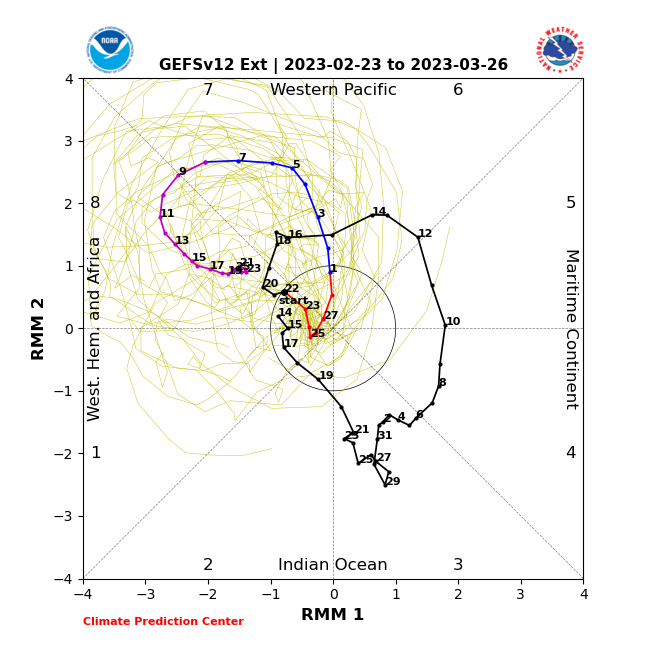
Of some concern is what the MJO is forecasted to do toward and around the middle of March. I have posted the latest RMM Phase Space chart to show the MJOs strength as well as its location. It will be getting very amplified has it gets back into the RMM 7-8 area. The MJO; “Madden Julian Oscillation” is supposed to be strong in this area toward mid March. It can force a “Pseudo El Nino effect” with higher heights in the PNA region, and sometimes, extend the East Asian Jet, underneath a blocking high toward the west coast. At the least, the pattern over the far eastern pacific should become milder later week 2 into Week 3, with the absence of Arctic Air. Milder weather could be just warmer or fair weather, or it could be milder and wet with storm’s associated with Atmospheric Rivers.
I will be watching with interest, what happens during that week 2 to week 3 period….
The Dweeber……….l👍
?
Dr Howard and the Dweebs…………………..:-)


