Brought to you by Howard Sheckter
MJO Tropical Forcing is ending as Classic Anti Cyclone is dissipating over the North Pacific….Like a two mile long freight Train…..It will take time to slow down…..Mother nature takes her foot off the gas peddle and the extension of the EAJ pulls back later this week……
Sunday March 12, 2023
3/14/2023 9:00AM
(Click on Title to get formatted discussion)
Bishop picked up 2.31 inches storm total; Looking forward to the DWP update!! 🙂
Mammoth Mt at the base lodge reported 60 inches, upper mountain possibly picked up 7+ feet as it was colder.
The Town got a few feet of Sierra Slop.
The next storm is not as warm as Thursday’s storm, so the snow level will be below 8000.
Expect 2 to 3 feet in town, with 3 to 4+ feet on Mammoth Mt by Wednesday Night.
There will be a break Thursday.
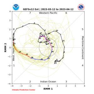
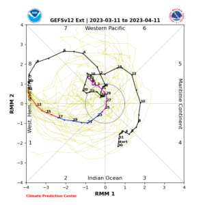
The MJO (tropical forcing) weakens rapidly later this week as the complete collapse of the East Asian Jet is expected.
Storms will trend weaker and cooler this weekend then colder next week as the MJO dives into the Circle of Death!
By April, the MJO Re-Emerges in phase 7. However, by then it is April, and may no longer have any affect on the Pacific Jet Stream….
___________________________________________________________________________________________________________________________________________________
3/12/23 at 2:25PM
24 hour snowfall forecast for the Town of Mammoth from 4:00AM Sunday Morning to 4:00AM Monday (4 to 12 inches)
4 day snowfall forecasts (Sunday through Wednesday) for Mammoth Mt. (4 to 7 feet)
Note, this next storm will be cooler with the snow level about 1000 feet lower.
Pattern is winding down, so after the mid week AR, forecasts will be come more challenging; Any Subtropical Taps into WX fronts over Central and Northern CA will be much weaker.
LADWP will be out with their update for Mammoth Pass, hopefully this new week. We have got to be getting close to 90 inches. That is the high mark (1983). Bet were there by next weekend?
_________________________________________________________________________________________________________________________
Current RMM MJO chart
Notes from the Dweebs….
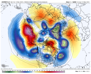
During March 5th, 6th and 7th, amplification was occurring leading up the Classic Closed Upper Anti-Cyclone SE Alaska. The extension of the the East Asian Jet resulted, further energized by the coupled series of upper lows dropping out of the Gulf of AK over the Anti-Cyclone. On the 8th, a powerful level 3 AR hit the California Coast bringing copious amounts of rainfall on the lower elevation snow pack. The Dweebs had forecasted the possibility of a major AR well back in February, (Read past discussions) as the RMM was bullish in this scenario during the 3rd week of February. The Global models only gave it a 10% to 15% chance of occurring as late as early March 3th/4th. A strong MJO in phases 7/8 is like putting your foot on the gas of a 1000 HP engine in a Deuce Coupe. Looking below, this MJO was off the chart.
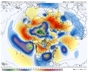
The Closed Anti Cyclone was still intact this morning, but is weakening:
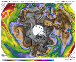
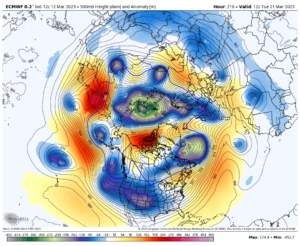
The EAJ extension is still intact allowing one more Atmospheric River to hit CA Tuesday
Mother Nature takes her foot off the GAS………………..
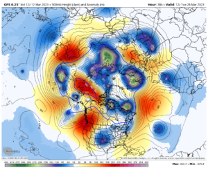
One more weaker but colder system try’s to make it was in Sunday the 18th through 21st
Then quiet time for the high county? Well see……
Afterall, only a fool makes a prediction on the 1st of April…especially during a year like 2023 🙂
_____________________________________________________________________________________________________________________
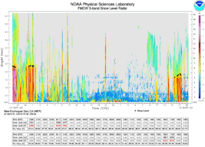
This is what the snow level has done the past several hours directly to the west of us along the Sierra foothills
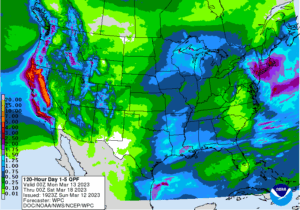
Here is the QPF from WPC through next Sunday the 12th
Hang in there…..The 2023 ski season with full operations will begin shortly 😉
PS; the Hype is already going on about El Nino. Yes it looks like El Nino will make a return in the Fall. However, it does not mean a thing for a wet winter unless it is Full Basin El Nino. The Modoki or Partial Basin El Nino is a sucker bet!
