Brought to you by Howard Sheckter
Sierra Storm dropped 10 to 14 inches of Powder on Mammoth Mtn….Snow Showers will Continue Today…..It will be Milder by Mid Week……..
Saturday December 7, 2013
Sunday AM Update:
Cold……Cold…… Yesterday’s high temp briefly peaked at 15 degrees. However most of the day ranged between 10 to 14 degrees. Winds in town were clocked 25 to 30mph with gusts to 52 MPH. Hence wind chill’s ranges from -5 to -15 all day!
Early Sunday morning temps were colder then a snakes vest button with -0 to the -35. Anchorite, NV near Hawthorn, NV had an unofficial low of -35 this morning, Bridgeport -14, Cold springs up north of Stead NV on the California side -22, -19 at Tuolumne Meadows and the list goes on and on. Mammoth Lakes had an official -8 this morning in town while the Mammoth AP had -8. Crestview -13 and Bodie -26F. Expect another cold night tonight.
Inversions:
This upcoming week the upper elevations will recover temperature wise as the freezing level goes up to 10,500 feet by Wednesday afternoon. Temperature inversions along with a decline in air quality will result. Those residents with out EPA approved wood burning devises should pay attention to local advisories on wood burning Tuesday and Wednesday of the upcoming week.
A change in the pattern to a dry one seems evident in the medium and long range charts, as heights rise over the eastern pacific in response to the break down of the block in the G of Ak (-epo) and the redevelopment of the (-wpo) the block that will set up for a while in the vicinity of the dateline then westward. Again this will cause height rises and along with that, the return of the upper jet to the pacific northwest and BC.
Milder days and Dry weather looking likely in the weeks to come.
Dr Howard and the Dweebs…………………..:-)
Quick recap this AM…..Much of the snow in town has blown and drifted. Some areas have 5 inches while others 2.5 feet in drifts. Winds clocked to 60 miles per hour buffeted the local neighborhood’s of Mammoth Lakes at 5:00am. Winds are still in the 30 to 40 MPH class in town while upper elevations….winds over 100 MPH. The upper jet max is in the vicinity and will keep the winds going all day. They should gradually diminish later today and tonight some. There is one more little feature coming down in the upper flow early Sunday Am but no one is talking about it and will probably be benign. So for now…snow showers will be in the forecast today and possibly tonight as well. A cold blustery pattern for the time being….Highs in the teens and lows -0s.
Looking down the Road…. The current pattern breaks down between Sunday and Wednesday as the -EPO falls apart and give way to transition. The upper ridge in the Gulf of AK deamplifys and that air mass pushes into California for some warmth by mid-week. Beyond that, there are some ensembles members showing some energy coming through next Friday and again the middle of the following week. But nothing define.. The trend however…..is looking drier and milder as we go through the end of the month.
Lots of temperature inversions and air quality issues as a stretched out east-west positive upper height anomaly sets up over the Eastern Pacific.
From what the Dweebs see, the pattern over the pacific becomes very chaotic and it is doubtful that any forecaster has any great deal of confidence beyond the 5 to 7 day period with the short waves dampening through what is becoming a long wave ridge position over the eastern pacific. One thing is for sure, the Dweebs do not see any major wet storms in the next 6 to 10 day period. Possibly some small ones…
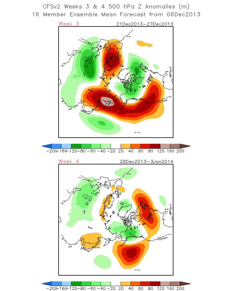
For what its worth…..CFS has the latter half of the month dry. So it is not all that encouraging as well.
SEE: http://www.cpc.ncep.noaa.gov/products/people/sweaver/cfs_fcst/images1/wk3.wk4_20131206.z500.gif
This winter is going to be a different animal. Weird, uncommon teleconnections are developing hemispherically that are unstable. There is so much going on globally weather-wise with record cold in parts of the NH and a lots of powerhouse storms over Eurasia and record early snows piling up in the Rockies….
Cant wait until we get our turn!
More later>>>>>>>>>>>>>
Dr Howard and the Dweebs……………………:-)


