Brought to you by Howard Sheckter
The Prospects for another AR are once again diminished…..However, Pattern to remain active over the next one to two weeks……
Friday March 17, 2023
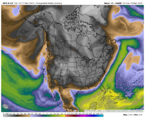
The weather maps are once again back peddling on the early next week AR. As I mentioned earlier this week, the EAJ has retreated and will have little influence on west coast weather very soon….This next AR stream does not appear to be strong on shore and is further south. todays hype in the news is not justified I believe. The snow level is below 7000 feet with it and lowers to 4500. So this is not a warm wet system as compared to ones in the past. I will post an example below. You can see that the rich moisture really does not push far into Central CA. It does help the QPF but not to the extent many of the others had. After this one, we are done as far as I can see. BTW, Scripps has not updated an AR 3 or better since the 06 UTC 03/16/2023 GFS run. That was two nights ago…
The Southern Sierra looks to benefit best with the Owens Valley getting some good precip next Tuesday. There are other weather systems to follow. As a point of interest, I have read that MJO induced wet west coast patterns with Atmospheric Rivers, effect the west coast for about 10 days. Today is day 10 so its probably over.
Today Saint Patty’s day, will be a beautiful one with light winds and lots of sunshine. Another dry day is expected Saturday, however, more clouds are expected earlier in the day. Highs today in Mammoth will be in the 30s with lows in the teens. The leading edge of the remains of the EAJ will move into the west coast Sunday with snow showers possible. There are two systems in this pattern. One for Monday that will bring winds and at least moderate snowfall and another that is deepening off shore that may focus most precip to our south. Nevertheless, between Sunday and Wednesday night, 2.5 to 4 feet is possible over the Southern and South Central Sierra, over 4 days.
A break looks to be in the cards Thursday. Then a weak cold splitting system with light snow is expected Friday the 24th. Again, this is late March now and models do a poor job in handling systems from a week 2 perspective this time of the year.
For what it is worth, another weather system following, looks stronger than the Friday system that may affect our area just after that following weekend. It’s a Monday the 27th through the 30th system. That may be a good snow producer based upon pattern recognition, as it is cold and showery and a has good over water trajectory, but don’t bank on it.
Looking way ahead, without any blocking over Hudson Bay Canada, I am afraid this years weather system’s will continue into CA, just weaking over time, possibly well into April or May. I guess big record winters don’t end abruptly. “Like die hard skiers and boarder, with age, they just fade away” 😉


