Brought to you by Howard Sheckter
Chilly Unsettled period setting up for the Sierra next week……A real oppertunity to break 875 inch snowfall record on top of Mammoth Mt…..A Record that is little chatted about but Monumental….
Sunday April 30, 2023
After near record high temperatures this week, the warm upper high is currently shifting east….500Mb Heights are falling, cooling is occuring in the coastal cities of Northern CA and breezy weather has returned. Being that the Sun angle is now mid August like, surface convection will occur where ever possible, except over snowcover. The closed low developing off the coast will create massive upper divergence over Eastern California. QPF indicated by the CRFC shows up to 1.40 over Yosemite during mid week. Freezing levels in the 5K to 7K range. Precipitation will be mostly convective and TSRW will produce the best amounts. Would love to see current 875 inch snowfall record amount over top of Mammoth Mt broken with possible 900 inches in sight. You never know as it could happen. In the meantime, the heavy spring thaw weather will take a back seat as colder temps will slow down the melt. Highs some days mid week will cool to the low 40s with lows in the 20s. Best days and nights for precip will be Tuesday through Friday. Hope Mammoth Mt keeps tabs on the snowfall on the upper Mt to see if a 900 inch record occurs by weeks end.
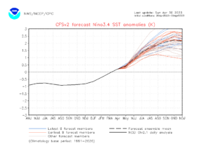
Next long range seasonal weather concern will be related to El Nino. El Ninos can be tricky. Big El Ninos are not always wet in California as they need to be “Full Basin” Will this be full basin warm El Nino? That will be up to the experts to varify. What’s a non full basin EL Nino” It’s called a Modoki event.


