Brought to you by Howard Sheckter
The cold in the west will give way to milder pacific air next week…It continues to be unlikely that any meaningful precipitation will fall until months end….
Wednesday November 16, 2022
9:50AM 11-18-2022
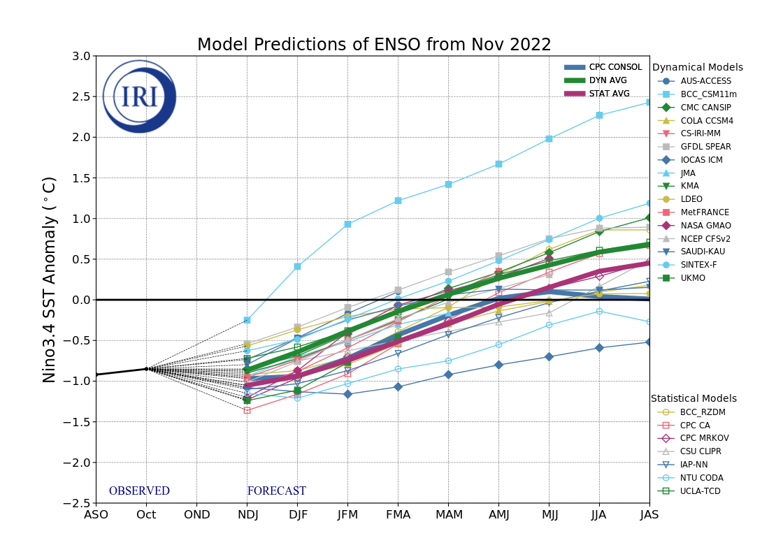
The New IRI graph is out and is indicated below. It continues the trend of ENSO going neutral during the Boreal Spring 2023. What’s encouraging is that the average in the graph shows -.5C by about March 2023.
That is the threshold of La Nina. More importantly, AR’s in CA, AKA Atmospheric Rivers, are the most numerous when ENSO is between -.5C and +.5C. So, we may be in for a wet Late Winter or Spring.
______________________________________________________________________________________________________________________________________________________________________________________________________________________
9:00AM 11-18-2022
Upper wave is approaching Mono County and 700MB winds are expected to increase over the Crest from the East. Mild pacific air is destined to invade the high country Sunday and although a weak wave moves in from the west Tuesday AM, it will only bring clouds and a wind shift. Thanksgiving will be Steller! Highs in the mid to upper 50s at resort levels, while Bishop basks in 65 to 70 degree daytime highs. Little or no change is expected the following Friday. If you live in the southland, expect high temps Thanksgiving day and the following Friday around 80 degrees!
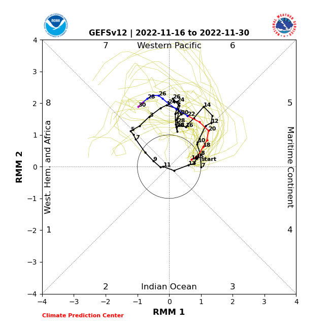
Our ridge breaks down later in the weekend. There is a storm that will try to get in here later Sunday. The models of course handle it differently. The main difference is if a blocking high develops near Greenland out over the Atlantic. The GFS builds this ridge and its effects would be to cause splitting of the Sunday/Monday system after the holiday. The European model does not and so the system is more progressive. There is another storm out there the following Tuesday or Wednesday as we wrap up the month of November. If you want to know why I am even bringing up an active pattern so far out, it is because of the likelihood of the MJO in the RMM as indicated below, in phase 7 which is wet for California, in November.
The Dweeber………………:-)
__________________________________________________________________________________________________________________________________________________________________________________________________________
Temperatures continue to be well below normal in the high country as a highly amped upper ridge along the coast, continues to pull down chilly air into the Great Basin. Although tomorrow Thursday will be briefly milder, another and last shot of cold drops into the Great Basin and brings more cooling into our area for Friday. Thereafter, our hemispheric pattern goes into transition. Beginning this weekend the coastal upper ridge both deamplifies and shifts east into the Great Basin, early next week. This will allow milder pacific air into Mono County with the result of warmer temps next week, especially toward Thanksgiving. Mammoth may even experience highs in the mid 50s by Thanksgiving or shortly thereafter. The high elevation valley temperatures will be well inverted and as the case was this morning, subject to periods of Freezing Fog and Pogonip’s. Temps will be in the 40s on Thursday and then back down into the low 30s on Friday, then 40s again over the weekend
Longer Range:
Both EC and GFS models in the longer range, (WEEK 2) show amplification of the central pacific ridge toward the end of the month. Thus, we have the opportunity for the redevelopment of an active pattern by then, as storms may once again drop out of Gulf of Alaska. This will be the Dweebs focus during next week on how the pattern evolves.
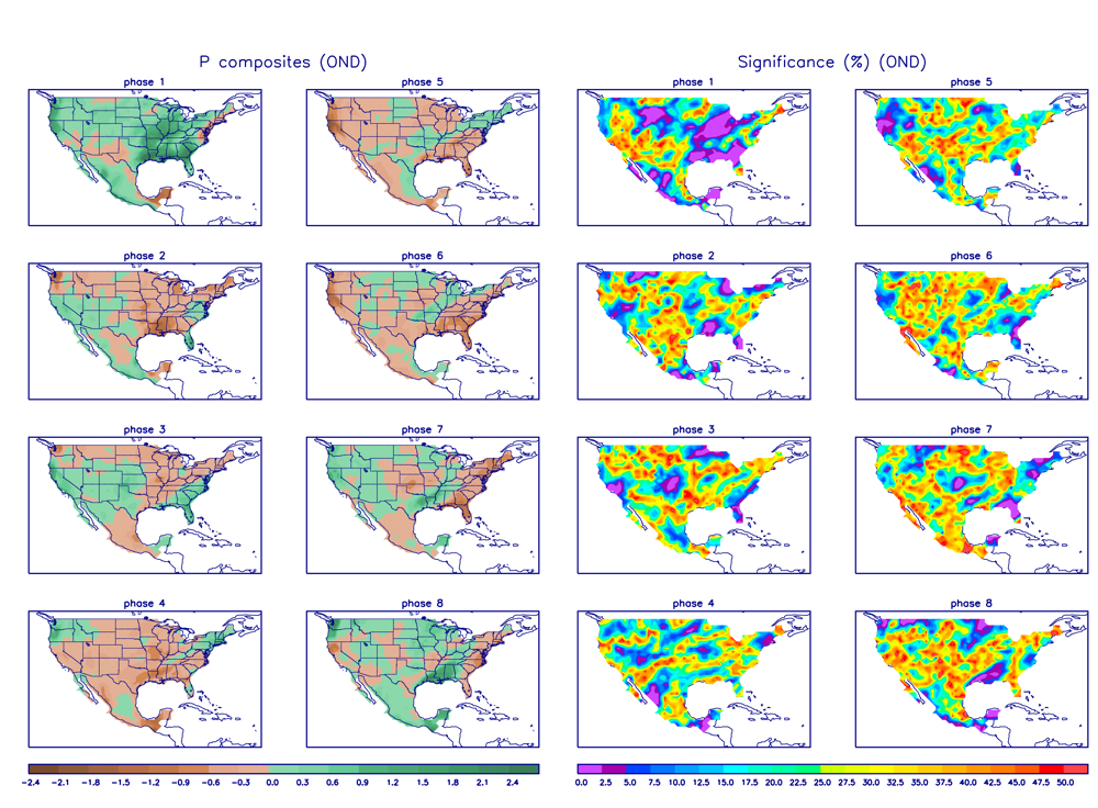
Below is the GEFSv12 RMM 1 and 2 Phase Space. Looking at the MJO and/or other tropical modes of variability. It looks like it goes into Phase 7. Looking at the composites for November in Phase 7, it is wetter than normal for California. This tool can give support to week 2 model forecast at distance, and in this case, a stormy end of the month! 🙂
Dr Howard and the Dweebs……………………….:-)