Brought to you by Howard Sheckter
Next AR moving in tonight with Heavy Snowfall expected toward midnight into Thursday AM….There will be a break Friday/Ngt with light snow first half of the day Saturday…..
Wednesday January 4, 2023
This appears to be the year of the AR as the Scripps graphics shows 5 ARs between today and mid month. (See graphics below) of course the data can change but this is today’s snap shot. The screaming message this mornings says that there are still a series of storms out there that have the potential of dumping a lot of rain and snow over Central and Northern CA. Snow levels will fluctuate and there most likely “will be periods” of rain or very wet snow in town over the next two weeks.
Now that soils are saturated in many areas of Central and especially Northern CA, the possibility of significant flooding along main stem rivers will be increasing as we head toward mid month.
For Mammoth, our history shows local street flooding to be the main issue during especially warm wet ARs along with avalanches. At the moment, the ARs appear to be cold enough for snow in town. Lets hope it stays that way! However, it is a very good idea to make sure that drainage in the lower elevations of town is free from ice and snow as best as possible. Historically, areas especially susceptible are in the Sierra Valley Sites subdivision and parts of Old Mammoth along the Mammoth Creek.
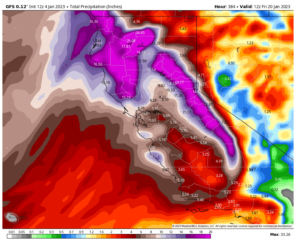
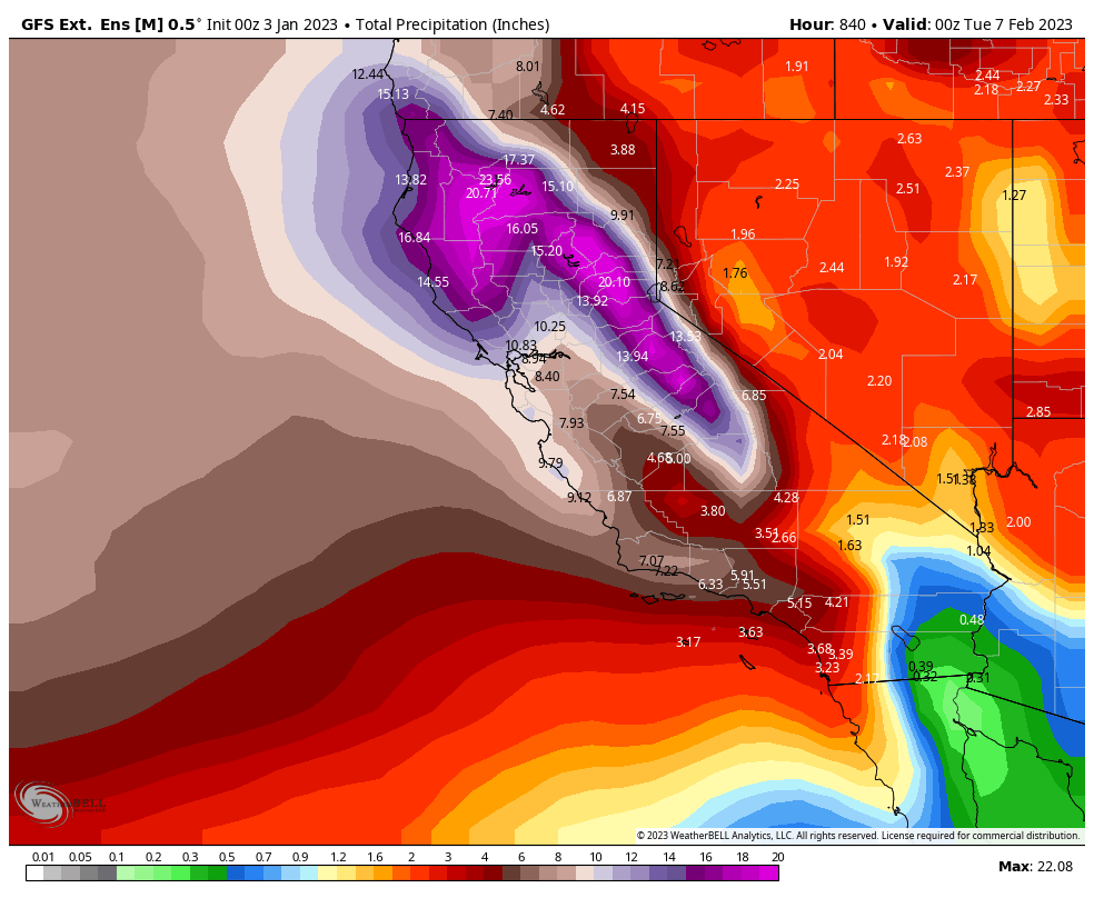
Below is a snap shot of the graphic from Scripps on the AR forecast. The strongest AR’s can be associated with the warmest temps. Another graphic is from the GFS ensemble from last nights run covering the period today through first week of February for the quantitative precipitation forecast
Additionally, precipitation is 155% of normal on the west side of the our portion of the Sierra.

This mornings deterministic run for the gfs/ 12z 1-4-2023