Mammoth Weather
Brought to you by Howard Sheckter
Brought to you by Howard Sheckter
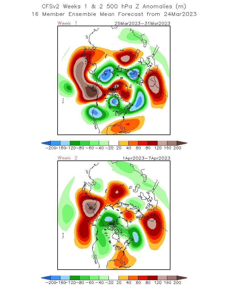
Although another Moderate storm is headed for the Town of Mammoth, There are encourging developments in the Week 2 Progs showing retrogression of the long wave Trof westward and upper ridging developing over the far west mainly April 6th on. This, if correct will give us a nice break from storms after the system on the 28th. However, although La Nina has been over for a while, the state of the weather pattern over the Pacific has been one of La Nina State with a negitive PNA pattern or the long wave trof prevelent over the far west in the mean. Looking at the CFS, (Climate Forecast System) the model still keeps a long wave trof over the far west in the mean for sometime. Thus, even though a longer break in storms for CA is possible, it is too early to say winter is over.
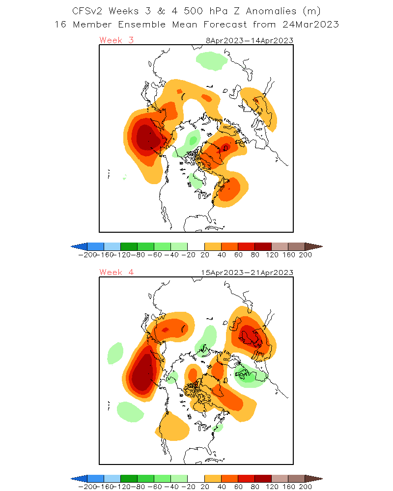
Looking at todays teleconnections, There is plenty of negitive phase in the PNA to say that the La Nina like teleconnection is not over yet! Weeks 3 and 4 maybe more encourging.
Lets give it another week or two to see how things develop!

 |
|
|
|


